
English
.
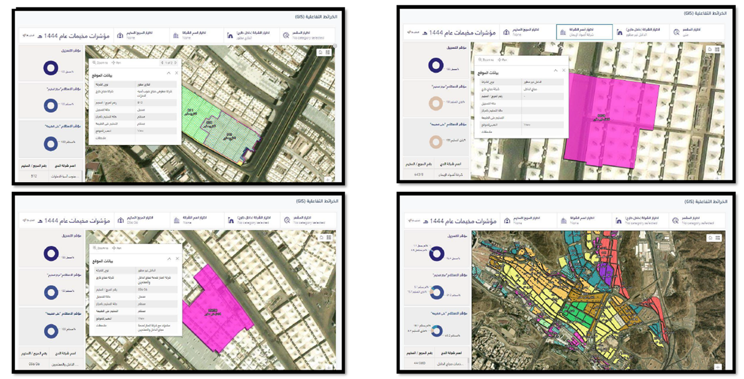
Convert and analyze spatial data into useful information that can be used to understand and analyze spatial relationships and geographic patterns.
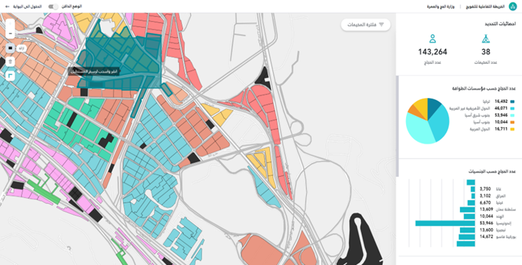
Create and improve technological structures that allow the exchange of geographic data between multiple sources. These portals can help improve interaction with spatial data and facilitate its use in different contexts.